Submitted by Norm Roulet on Wed, 05/05/2010 - 00:20.
We are still at an early stage in awareness of issues surrounding the 2010 BP oil spill in the Gulf of Mexico, including the amount of oil flowing from the spill daily and the effectiveness of efforts to stop the flow of oil and clean-up the mess - below are some of the latest estimates and updates as reported by various sources. Most interesting now is the forecasting of how all this oil - best or worst case - will travel through the gulf and ocean currents and impact nature and so all else on Earth. The best modeling of this I have seen is by the The College of Marine Science - USF, Ocean Circulation Group, which maintains a coordinated program of coastal ocean observing and modeling for the West Florida Continental Shelf (WFS) - you may see their models animated with projections through May 8 in the links below. For an excellent article on the anticipated impacts on Florida of this oil spill, I have also included part of an article from the LA Times, with link to that - these seem to be the latest accurate reflections on this horrible situation, as of May 4.
From Some oil spill events from May 4, 2010 - By The Associated Press (AP) – 3 hours ago
The Associated Press reported Thursday that some oil washed ashore at the mouth of the Mississippi River along the Louisiana coast. So far only sheens have reached some coastal waters.
A satellite image taken Sunday night indicated that the slick had shrunk from 3,400 square miles to 2,000, but it just meant that more was under water, said Hans Graber of the University of Miami.
Executives from BP PLC tell members of a congressional committee that in the worst-case scenario, a leaking well could spew up to 60,000 barrels of oil in the Gulf. Rep. Ed Markey, D-Mass., says industry officials told the House Energy and Commerce Committtee Tuesday the scenario translates to 2.5 million gallons a day. A more likely scenario if the leak gets worse is 40,000 barrels, or 1.7 million gallons.
From Gulf oil spill: Florida braces for impact - Los Angeles Times - May 4, 2010
As the powerful Loop Current, a surge of warm water that circulates in the eastern Gulf of Mexico, moved north within 30 miles of the spill, scientists predicted that it would catch the the oil and sweep it around the Florida peninsula. The oil could then contaminate the Everglades National Park, along with mangrove swamps, coral reefs, sea grass and the animals and fish that depend on them, they said. Beaches in Miami and along Florida's eastern coast could be tarred.
“Where it hits will be devastating,” said James Fourqurean, a sea grass ecologist with Florida International University. “But it is not going to hit everywhere.”
“Filaments of the Loop Current are within tens of kilometers of the oil spill,” said Robert H. Weisberg, an oceanographer at the University of South Florida who has been modeling the movement of the spill. Once the current catches the spill, he said, “the speed of the current is such that it only takes a week before oil will be at entrance of the Florida straits and another week until it gets as far as Miami.… Whether the oil gets into the Florida Bay or the Everglades depends on what local winds are doing when oil is flowing past.”
Weisberg said he could not predict the exact timing. “But it appears to be imminent," he said. "It looks like it is going to happen sooner rather than later...The Loop Current moves very fast.” As for the oil's trajectory, he said, “Whatever comes will flow west of Dry Tortugas and towards Cuba before it comes back north.” For the oil to get into the vicinity of shallow water in the Florida Bay, Weisberg said, the current "would have to take oil into passes from south to north. It is difficult to get a lot of oil into the Florida Bay."
Robert H. Weisberg, an oceanographer at the University of South Florida who has been modeling the movement of the spill.
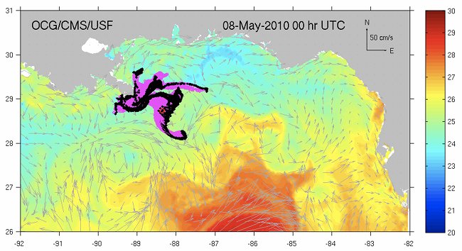
The College of Marine Science - USF, Ocean Circulation Group maintains a coordinated program of coastal ocean observing and modeling for the West Florida Continental Shelf (WFS). Modeling includes a West Florida Shelf version of ROMS nested in the Navy's operational HYCOM. We are also diagnosing model output from the Navy's HYCOM and also from the NOAA RTOFS. All of these model-based, oil spill trajectory forecasts, each updated daily with new wind forecasts and new satellite derived oil location reinitializations are provided below.
· WFS Model Forecasts
· WFS Model Oil Spill Trajectory Hindcast/Forecast (superimposed with winds) New!
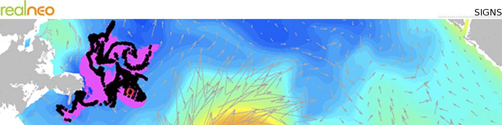
· WFS ROMS Oil Spill Trajectory Hindcast/Forecast (with surface currents and SST) New!
· HYCOM based Oil Spill Trajectory Hindcast/Forecast New!
· ROTFS based Oil Spill Trajectory Hindcast/Forecast New!

